Sideform / 02 / MunggiFree · no account
Sleep outside,without guessing.
A map of Switzerland showing where tent, bivouac and vehicle overnight stays are allowed, conditional or forbidden — with source and date on every area.
Open Munggi(opens external site)munggi.app
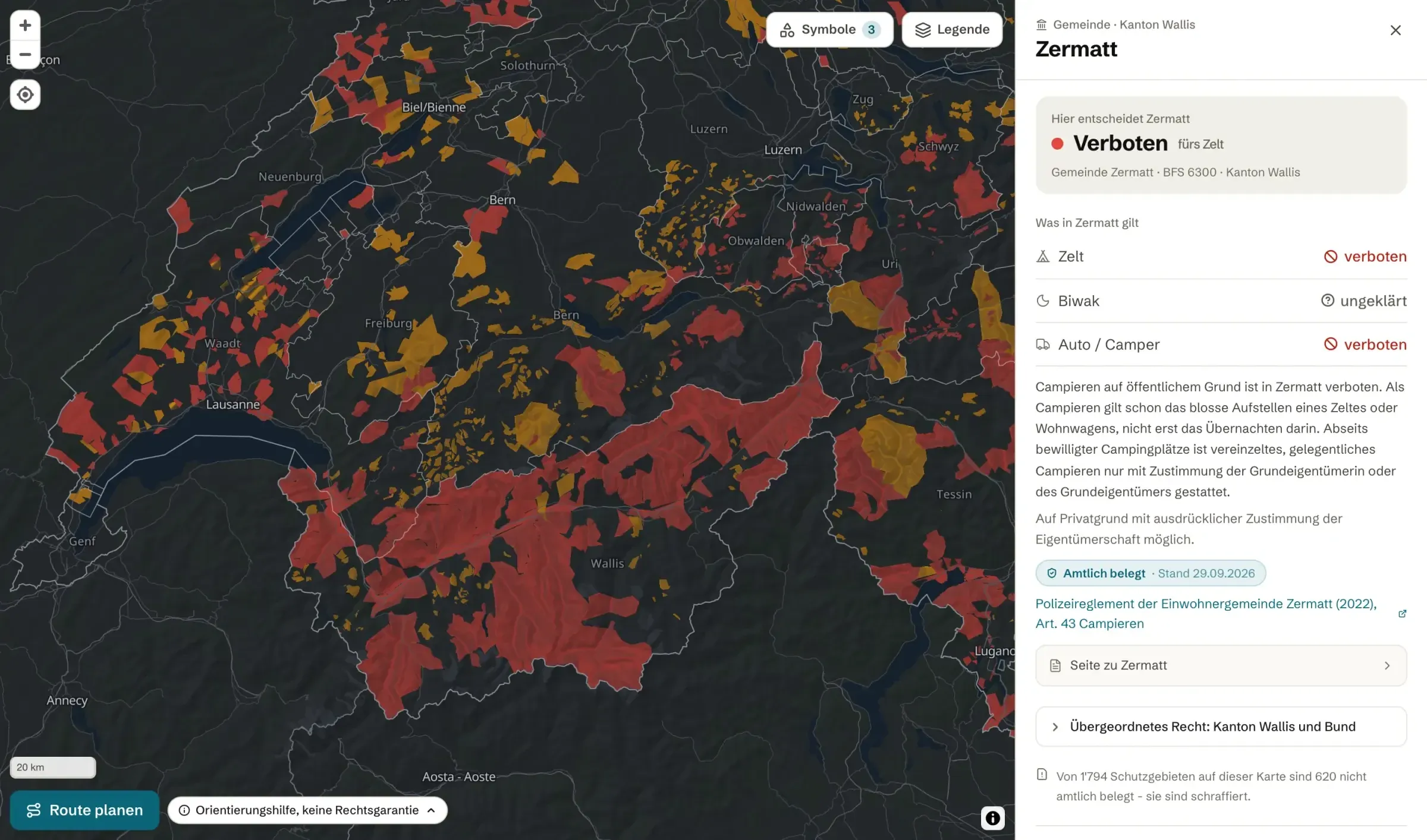
- Allowed
- Conditional
- Forbidden
What’s in it
Plan a night out, from the map to the packing list.
- 01
Legality map
Tent, bivouac and vehicle stays, marked as allowed, conditional or forbidden. Every area shows its source and date.
- 02
Route check
Draw a route or import a GPX file, and see which zones it crosses.
- 03
Huts, campsites, drinking water
The places you need around a night outside, on the same map.
- 04
Tour planning
Elevation profile, stages, weather and a packing list for the tour.
- 05
Municipality pages
One page per municipality, with its rules and where they come from.
camping-map.com(opens external site)
Facts
- Free
- Use the full map at no cost.
- No account
- Open it and use it.
- App
- A native app is in development.

Check before you pitch.
munggi.appOpen Munggi(opens external site)
Munggi summarises public rules and shows their source and date. It is a guide, not a legal guarantee. Signs on site take precedence.